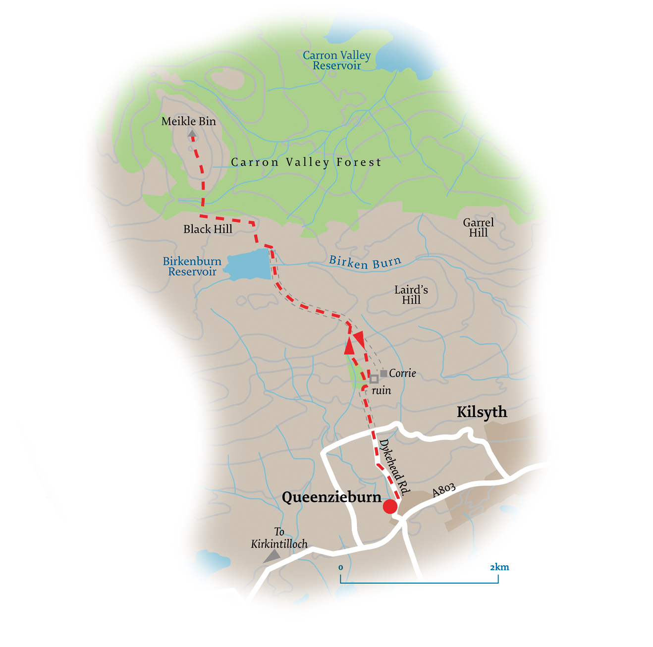
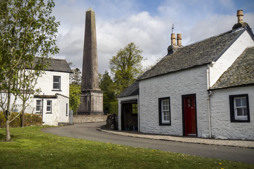
Killearn and the Endrick Water
Distance – 7.9km
Time – 2 hours
Terrain – country roads and unsurfaced riverside tracks
Map – OS Explorer 348
Access – regular buses to Killearn from Stirling and Glasgow
This peaceful walk leaves Killearn to trace a route through the countryside before following the Endrick Water back to the start. The Endrick lies on a popular drove route through the Carron Valley from Drymen. Indeed, its name is thought to derive from the Old Celtic word anderik, meaning ‘heifer’.
Beginning at Killearn Village Hall on Balfron Road, cross Station Road and head out of the village, following the footpath by the A875 for 1.5km.
Where the B818 to Fintry forks off on the right, veer downhill on the minor road to Balfron Station. After 500m or so, head along the signed public path to Boquhan, which is lined with oak and beech trees. This is Jenny Gunn’s Loan. The daughter of a veteran of the Napoleonic Wars, Janet Gunn, known as Jenny, was born in Boquhan in 1821. She lived in her father’s home in Boquhan until her death in 1904.
Beyond the village, rejoin the A875 and follow it downhill. Just before the Endrick Water, take the wide tree-lined vehicle track that leads off along the riverbank.
Rising in the Fintry Hills, the Endrick Water is formed from the confluence of the Burnfoot and the Backside Burns. It flows south from the hills before veering westwards near the western dam of the Carron Valley Reservoir. From there, it flows through Strathendrick, passing Fintry, Balfron and Drymen before entering the southeastern corner of Loch Lomond. The river is teeming with wildlife – look out for kingfisher, oystercatchers and redshanks.
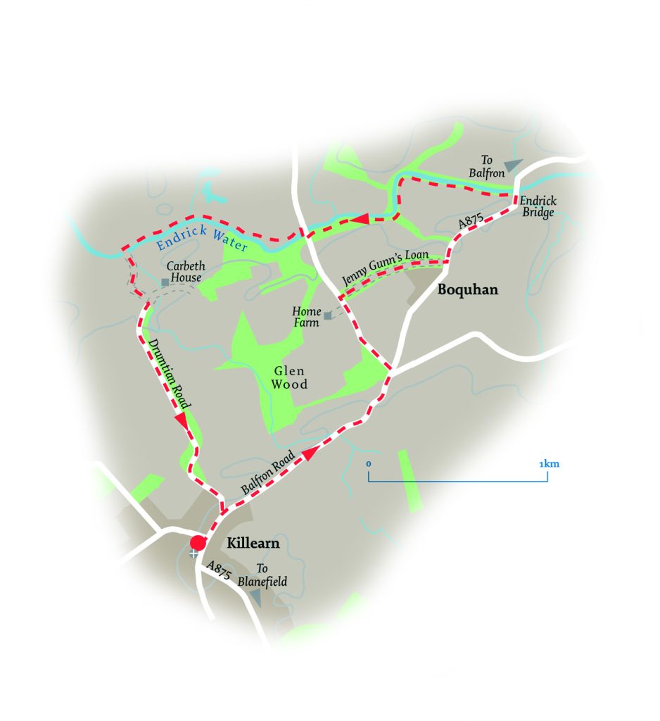
Reaching a field, a narrow track continues along the riverside, quickly becoming a pleasant woodland amble.
Soon after crossing a burn, a couple of bridges come into view. After going through an old metal gate beneath the modern roadbridge and the stone archway of the older bridge, climb up to cross the old bridge. As part of the scheme to provide Glasgow with fresh drinking water from Loch Katrine, this bridge was built in 1864 to carry both the pipe and a road across the Endrick Water. There are staircases providing access to the pipe at either end. The pipe burst in the 1990s and the bridge was replaced by the modern roadbridge next to it.
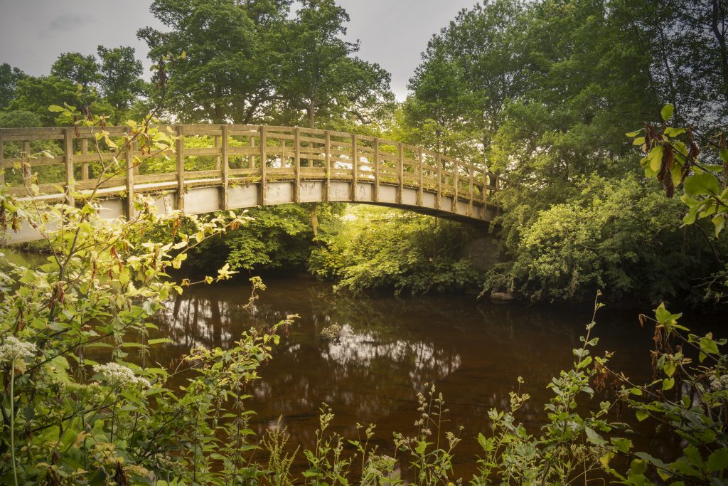
Drop back down to the river on the other side of the bridge, meandering along the bank to reach a wide, deep burn. Divert briefly upstream to cross at a small metal footbridge before returning to the river. Cross a stile, presently arriving at a wooden footbridge across the river.
Cross the bridge and walk uphill away from the water, bearing right onto Drumtian Road and following it back into Killearn.
Pocket Mountains Books are available from Waterstones Byres Road and all Good Bookshops.
Return to Travel and Leisure